GeoAI for Land Intelligence
Turning pixels & geodata into actionnable insights.
.png?width=500&height=500&name=LI%20(8).png)
Land Intelligence Solutions
Operate sustainably, optimize resources management, and inform decision-making.
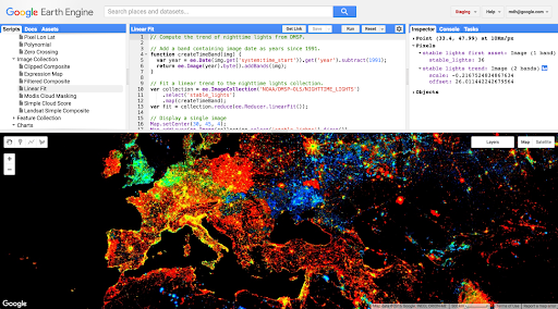
With Google Earth Engine
Powerful platform dedicated to geospatial data large-scale analysis, offering a vast catalog of + 90 petabytes of analysis-ready data.
- Planetary-scale analytics platform : Quickly process and analyze massive volumes of geospatial data from various sources.
- Environmental monitoring tool : Follow the evolution of our planet and detect environmental changes.
- Climate risk modelling : Assess and predict the impacts of climate change.
- Proactive resource management : Optimize land and natural resource uses.


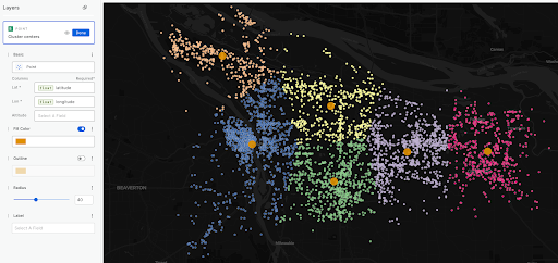
With CARTO
Cloud Data Science platform to automate data preparation and analysis pipelines, in Low-code.
- Intuitive visualization : Present complex data, even the largest, clearly and efficiently.
- Trend detection : Quickly identify hidden trends and correlations in your data.
- Predictive modeling : Anticipate future developments and make informed decisions.
- Custom reports : Generate detailed and interactive reports to communicate your results effectively.
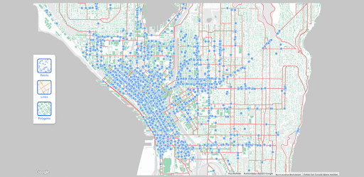
With Google Maps Platform
A suite of mapping tools and services to develop custom applications and integrate location capabilities into your solution.
- Data visualization : Represent your geographic data in a clear and intuitive way on an interactive maps.
- Route planning : Compute the most efficient routes based on different criteria (distance, time, traffic, etc.).
- Custom integration : Easily integrate Google Maps Platform features into your existing applications.

The power of geospatial for a multitude of use cases
.png?width=1200&length=1200&name=LI%20(2).png)
Agriculture
Optimize crop yields. Monitor health. Develop sustainable farming practices.
Explore
.png?width=1200&length=1200&name=LI%20(4).png)
Urban planning
Predict urban growth over space and time. Monitor air pollution and population exposure. Quantify surface urban heat island.
Explore
.png?width=1200&length=1200&name=LI%20(6).png)
Energie renouvelable
Solar Propensity Analysis. Optimize location planning for wind turbine.
Explore
.png?width=1200&length=1200&name=LI%20(3).png)
Natural resources
Monitor land use and land cover change. Enable sustainable forest management. Monitor surface water and groundwater.
Explore
.png?width=1200&length=1200&name=LI%20(5).png)
Supply Chain
Enable global supply chain transparency and traceability to footprint.
Explore
.png?width=1200&length=1200&name=LI%20(7).png)
Climate risks
Predict financial impacts of extreme events. Manage exposures to climate risks. Understand risks to long-term investments
Explore

Arkeup GIS, partenaire privilégié de Google Cloud renforce son expertise dans l’optimisation du dernier kilomètre, et devient Distributeur-Intégrateur de Last Mile Fleet Solution de la plateforme Google Maps.
Toute la richesse, la puissance et la popularité de la plateforme Google Maps Platform pour :
Piloter votre flotte
et optimiser vos livraisons

Guider vos chauffeurs
et optimiser les séquences de missions

Informer vos clients
en temps réel et avec précision

Augmentez vos ventes et fidélisez vos clients en leur offrant des livraisons programmées avec précision!

La plateforme cartographique la plus riche du marché!
Land Intelligence solutions presentation
Let’s explore solutions and possibilities together support you from project framing, in the deployment, as well as in the evolution.
Book for a demo now !